
Afan Forest Park – Visitor Centre, near Port Talbot
Main starting point for mountain bike and walking...
The walking trails are closed.
The following mountain bike trails are diverted:
The play area has been temporarily removed due to storm damage.
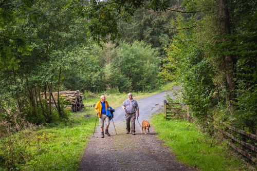
Our car park is situated just outside the village of Abergorlech and is the starting point for three walking trails and a mountain bike trail in Brechfa Forest.
One of the walking trails goes to a forest garden, where Forestry Commission staff planted a variety of trees in the late 1950s to see how well they grew.
Gorlech is the name of the river which joins the Cothi nearby. Strangely shaped stones have been found in the river, and examples of these ‘Gorlech Stones’ are displayed in the front gardens of cottages in the villages.
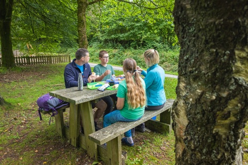
There is a picnic site and children’s play area in the car park, and portable toilets.
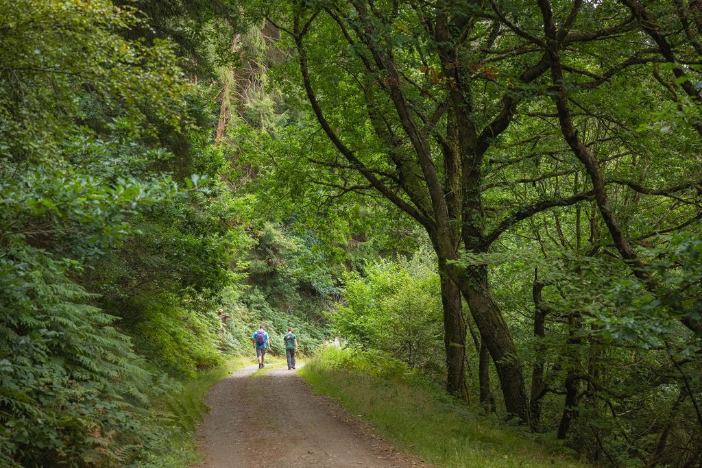
The walking trails are waymarked from start to finish.
Look out for the information panel at the start of the trail.
Find out about walking trail grades.
This woodland trail goes alongside the river Gorlech, over a bridge and then returns along the forest road.
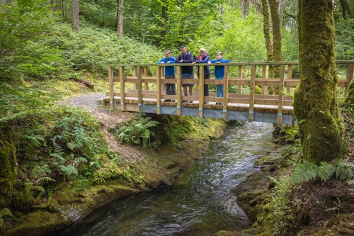
This trail follows the river Gorlech and climbs uphill through an attractive range of woodlands.
Try our Forest Garden Trail to see trees from all over the world – giant redwoods from California; eucalyptus from Australia; nothofagus from South America; firs from all the continents and a variety of European species like sessile oak, walnut and spruces.
Instead of one or two trees of each type of tree, you will find a whole stand.
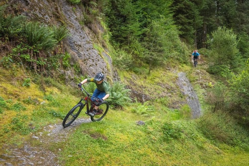
All our mountain bike trails are waymarked from start to finish and have been graded for difficulty.
At the start of the trail there is an information panel – please read this before setting off.
This trail is a hard, fast, all weather surface which becomes more and more exciting as your skill level and speed progress.
Highlights include perfectly sculpted berms and huge switchbacks, jumps and tabletops.
Brechfa Forest is the modern name for part of the ancient Glyn Cothi Forest.
Glyn Cothi Forest was managed for centuries by local people in order to provide building materials, products and grazing.
In 1283, following the final defeat of Wales by Edward I, Glyn Cothi became a Royal Forest administered under Forest Law for several centuries.
Since those days a very different forest has developed. In the 1900s Brechfa Forest was replanted with conifers by the Forestry Commission to boost Britain’s timber reserve after the heavy use of timber in the First World War.
Brechfa Forest covers some 6500 hectares and is looked after by Natural Resources Wales for the benefit of people, wildlife and timber production, and more recently the production of wind energy.
There are walking and mountain bike trails from these other Natural Resources Wales car parks in Brechfa Forest:
We want you to return home safely after your visit here.
You are responsible for your own safety as well as the safety of any children and animals with you during your visit.
For advice and tips to help you plan your visit here go to Visiting our places safely.
Please check the top of this webpage for any changes to these opening times.
The portable toilets are open at all times.
See the top of this webpage for details of any planned closures or other changes to visitor facilities here.
For your safety, always follow instructions from staff and signs including those for trail diversions or closures.
We may divert or close trails whilst we undertake maintenance work or other operations and we may need to close other visitor facilities temporarily.
In extreme weather, we may close facilities at short notice due to the risk of injury to visitors and staff.
You may need permission from us to organise an event or to carry out some activities on our land.
Check if you are allowed to use our land.
We recommend you follow these directions or use the Google map below which has a pin on this place’s location.
Abergorlech is 17 miles north east of Carmarthen.
Take the A40 from Carmarthen towards Llandeilo.
After 4 miles, in the village of Nantgaredig, turn left on to the B4310 signposted towards Brechfa.
Continue through the village of Brechfa and go past the Byrgwm car park.
After going through Abergorlech village the car park is on the left.
The Ordnance Survey (OS) grid reference for the car park is SN 586 337 (Explorer Map 186).
The postcode is SA32 7SJ. Please note that this postcode covers a wide area and will not take you directly to the entrance.
View this place on the What3Words website.
The nearest mainline railway station is in Carmarthen.
For details of public transport go to the Traveline Cymru website.
Parking is free of charge.
Overnight parking is not permitted.
There are no staff at this location.
Contact our customer team for general enquiries during office hours, Monday to Friday.


