
Afan Forest Park – Visitor Centre, near Port Talbot
Main starting point for mountain bike and walking...
A section of the circular walk through the woodland is temporarily closed due to damage.
Mill Wood is on Gower, just 12 miles from Swansea.
Originally part of the nearby Penrice Estate, this ancient woodland still has remnants of late 18th century landscaping and tree planting.
It is also home to the ruins of a watermill and fishponds which once supplied the kitchens of Penrice Castle.
Go through the gate from the parking area to the welcome panel with map and information about what to see. There is an another information panel by the mill ruins.
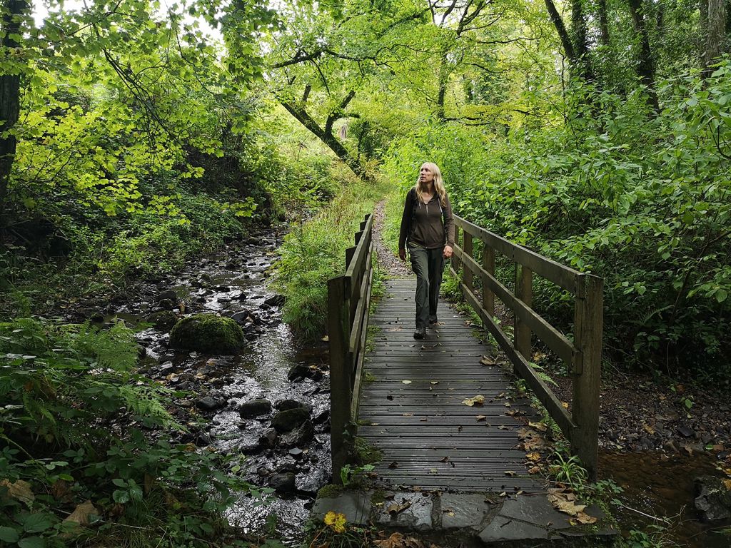
You can explore the woodland along the tracks and paths which are narrow and can be slippery and muddy.
In spring look out for bluebells, ramsons, red campion, cow parsley, marsh marigold, meadow sweet and male fern. There is also an area of wild daffodils.

You need a permit to horse ride in Mill Wood.
We want you to return home safely after your visit here.
You are responsible for your own safety as well as the safety of any children and animals with you during your visit.
For advice and tips to help you plan your visit here go to Visiting our places safely.
See the top of this webpage for details of any planned closures or other changes to visitor facilities here.
For your safety, always follow instructions from staff and signs including those for trail diversions or closures.
We may divert or close trails whilst we undertake maintenance work or other operations and we may need to close other visitor facilities temporarily.
In extreme weather, we may close facilities at short notice due to the risk of injury to visitors and staff.
You may need permission from us to organise an event or to carry out some activities on our land.
Check if you are allowed to use our land.
We recommend you follow these directions or use the Google map below which has a pin on this place’s location.
Mill Wood is 12 miles west of Swansea.
Take the A4118 from Swansea towards Gower and Port Enyon.
Continue through Penmaen and Nicholaston, passing the ruins and then turning left by the farm, signposted to Penrice.
Continue along this minor, single-track road for ½ mile and the parking area is on the right.
The Ordnance Survey (OS) grid reference for the parking area is SS 493 882 (Explorer Map 164).
The postcode is SA3 1LN. Please note that this postcode covers a wide area and will not take you directly to the entrance.
View this place on the What3Words website.
The nearest mainline railway station is in Gowerton.
For details of public transport go to the Traveline Cymru website.
The parking area is on the roadside, next to the woodland entrance.
Parking is free of charge.
Overnight parking is not permitted.
There are no staff at this location.
Contact our customer team for general enquiries during office hours, Monday to Friday.


