
Afan Forest Park – Visitor Centre, near Port Talbot
Main starting point for mountain bike and walking...
Pen Arthur Wood lies on the western edge of the Bannau Brycheiniog National Park.
This woodland is made up of an attractive mix of conifers and native broadleaved trees.
You can follow the forest roads uphill to enjoy views of the Tywi Valley on one side and of the Black Mountain on the other side.
You can also join the Beacons Way long distance route which passes close to Pen Arthur Wood.
The route is not waymarked.
See the information panel in the car park for the suggested route.
Find out about walking trail grades.
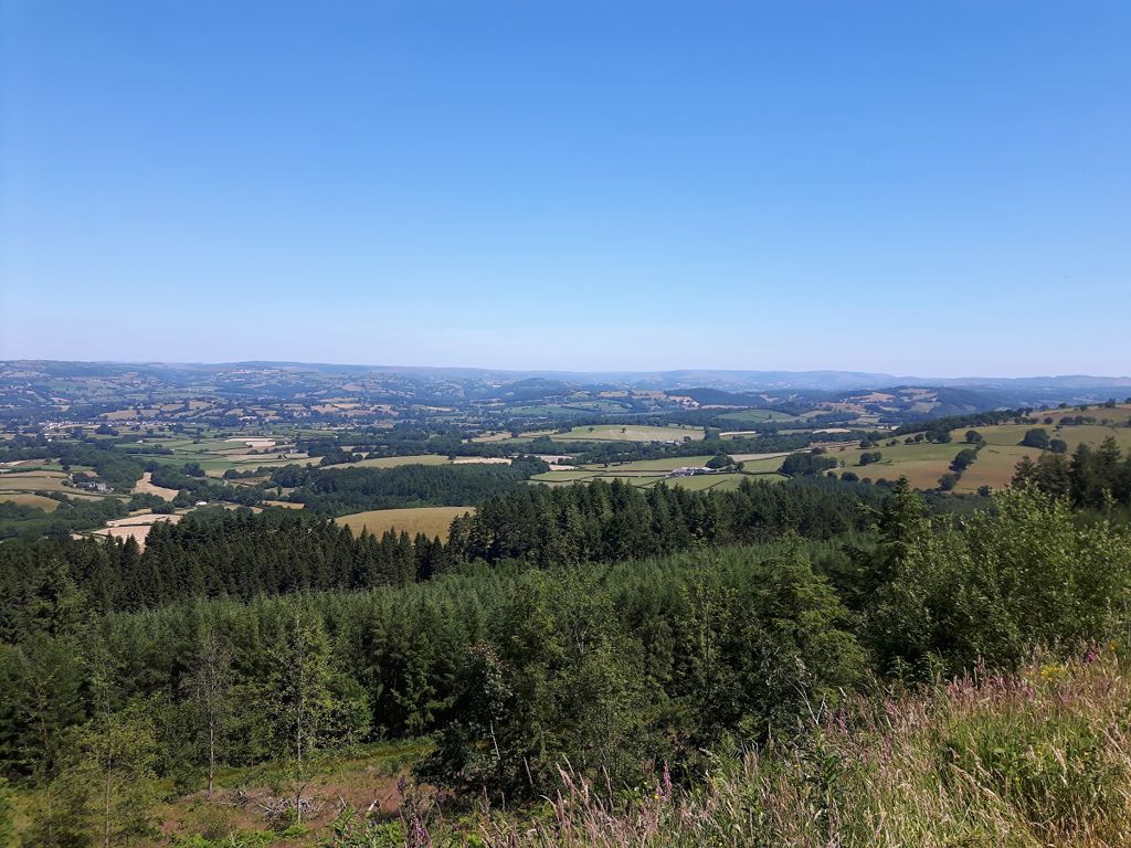
Great views on a clear day of the Black Mountain and the Tywi Valley are your reward for a long climb up to up to Banc Carreg-foel-gam (350m/1150ft above sea level).
The viewpoint is on a short circuit through moorland at the end of the forest road.

The Beacons Way is a 99 mile (159 kilometre) long distance route through the Bannau Brycheiniog National Park.
You can follow a public footpath from the Banc Carreg-foel-gam viewpoint in Pen Arthur Wood to join the section of the Beacons Way to the summit of Garn Goch.
For a circular route, you can return on a minor road to the east of the village of Bethlehem.
Please note that this suggested route is not waymarked and you are not on Natural Resources Wales land once you leave the wood.
For more information about the Beacons Way go to the Bannau Brycheiniog National Park's website.
Pen Arthur Wood is in the Bannau Brycheiniog National Park.
The National Park covers approximately 520 square miles of mountains and moorland in South and Mid Wales.
It is looked after by the Bannau Brycheiniog National Park Authority.
For more information go to the National Park's visitor website.
We want you to return home safely after your visit here.
You are responsible for your own safety as well as the safety of any children and animals with you during your visit.
For advice and tips to help you plan your visit here go to Visiting our places safely.
See the top of this webpage for details of any planned closures or other changes to visitor facilities here.
For your safety, always follow instructions from staff and signs including those for trail diversions or closures.
We may divert or close trails whilst we undertake maintenance work or other operations and we may need to close other visitor facilities temporarily.
In extreme weather, we may close facilities at short notice due to the risk of injury to visitors and staff.
You may need permission from us to organise an event or to carry out some activities on our land.
Check if you are allowed to use our land.
We recommend you follow these directions or use the Google map below which has a pin on this place’s location.
Pen Arthur Wood is 8 miles south west of Llandovery.
Take the A4089 from Llandovery to Llangadog.
Take the A4069 from Llangadog towards Brynaman.
After 2½ miles the entrance to Pen Arthur Wood is on the right.
The Ordnance Survey (OS) grid reference for the car park is SN 721 250 (Explorer Map OL 12).
The postcode is SA19 9PR. Please note that this postcode covers a wide area and will not take you directly to the entrance.
View this place on the What3Words website.
The nearest mainline railway station is in Llangadog.
For details of public transport go to the Traveline Cymru website.
Parking is free of charge.
Overnight parking is not permitted.
There are no staff at this location.
Contact our customer team for general enquiries during office hours, Monday to Friday.


