
Beddgelert Forest, near Beddgelert
Huge forest in the heart of Eryri National Park
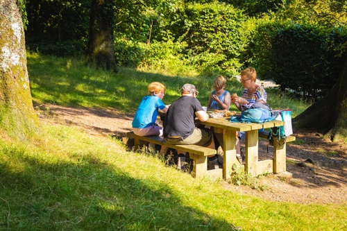
Tan y Coed is an easy-to-find picnic site located immediately off the A487.
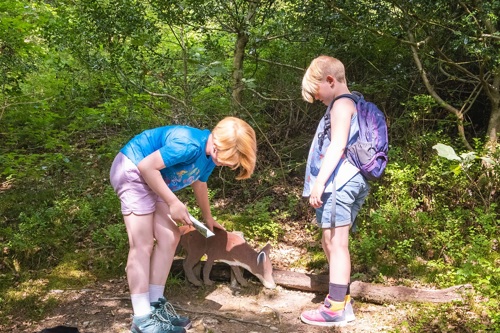
It is the starting point for a walking trail to a waterfall and an animal discovery trail for children.
There is a picnic site with tables amongst huge Douglas fir trees in the large grassy area around the car park.
The toilet block is in the car park.
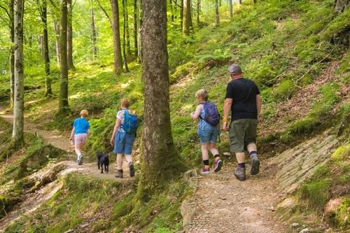
The walking trails are waymarked from start to finish.
Look out for the information panel at the start of the trails.
Find out about walking trail grades.
Be a nature detective on this special trail for children.
Pick up a leaflet from the dispenser outside the toilets or download a copy from the bottom of this page.
Then set off through the woodland and work out the clues to find the hidden animals in the trees.
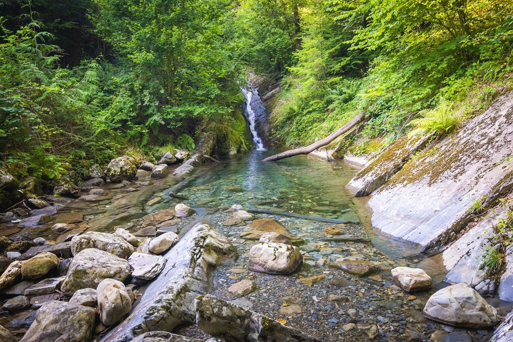
This trail uses some of the same paths as the Tan y Coed Trail and goes past the waterfall and through the rock passage.
Set off through the trees on the longer of the two trails through the woodland.
The route takes you to the waterfall and alongside the river.
Then squeeze through the rock passage and enjoy views over Dyfi Forest on your return to the car park.
The Forestry Commission began planting the woodland after the First World War to boost Britain's timber reserve and planting continued through the Second World War with Land Army Girls carrying out the work.
Listen to the story of the Land Army Girls, known as Timber Jills, on our audio trail.
The audio trail has been designed to be used along the Tan y Coed Trail, a waymarked walking route from the car park.
We recommend that you download the audio trail to your smartphone before your visit as mobile network coverage can be limited in rural areas.
Tan y Coed is part of Dyfi Forest.
Situated between the towns of Machynlleth and Dolgellau, Dyfi Forest lies in the shadow of Cadair Idris.
The woodlands cling to the steep hillsides of the Tarren and Dyfi mountain ranges cut through by the Dysynni, Dulas and Dyfi rivers heading west to the nearby sea.
The whole area was once filled with thriving slate mines, employing hundreds of people.
The finished slate was moved to the coast via a system of tramways and steam trains for export.
The remaining trains now carry holidaymakers through the countryside.
There are waymarked trails in these other Natural Resources Wales woodlands within Dyfi Forest:
Most of Dyfi Forest is in Eryri National Park.
Eryri is the largest National Park in Wales and is home to picturesque towns and villages and the highest mountain in Wales.
It is looked after by the Eryri National Park Authority.
For more information about visiting Eryri go to the Eryri National Park Authority website.
We want you to return home safely after your visit here.
You are responsible for your own safety as well as the safety of any children and animals with you during your visit.
For advice and tips to help you plan your visit here go to Visiting our places safely.
See the top of this webpage for details of any planned closures or other changes to visitor facilities here.
For your safety, always follow instructions from staff and signs including those for trail diversions or closures.
We may divert or close trails whilst we undertake maintenance work or other operations and we may need to close other visitor facilities temporarily.
In extreme weather, we may close facilities at short notice due to the risk of injury to visitors and staff.
You may need permission from us to organise an event or to carry out some activities on our land.
Check if you are allowed to use our land.
We recommend you follow these directions or use the Google map below which has a pin on this place’s location.
Tan y Coed is 3½ miles north of Machynlleth.
Take the A487 from Machynlleth towards Dolgellau.
After 3½ miles, the Tan y Coed car park is signposted on the left.
The Ordnance Survey (OS) grid reference for the car park is SH 755 053 (Explorer Map OL 23).
The postcode is SY20 9AT. Please note that this postcode covers a wide area and will not take you directly to the entrance.
View this place on the What3Words website.
The nearest mainline railway station is in Machynlleth.
For details of public transport go to the Traveline Cymru website.
Parking is free of charge.
Overnight parking is not permitted.
There are no staff at this location.
Contact our customer team for general enquiries during office hours, Monday to Friday.


