
Beddgelert Forest, near Beddgelert
Huge forest in the heart of Eryri National Park
Tyddyn Gwladys is in Coed y Brenin Forest Park.
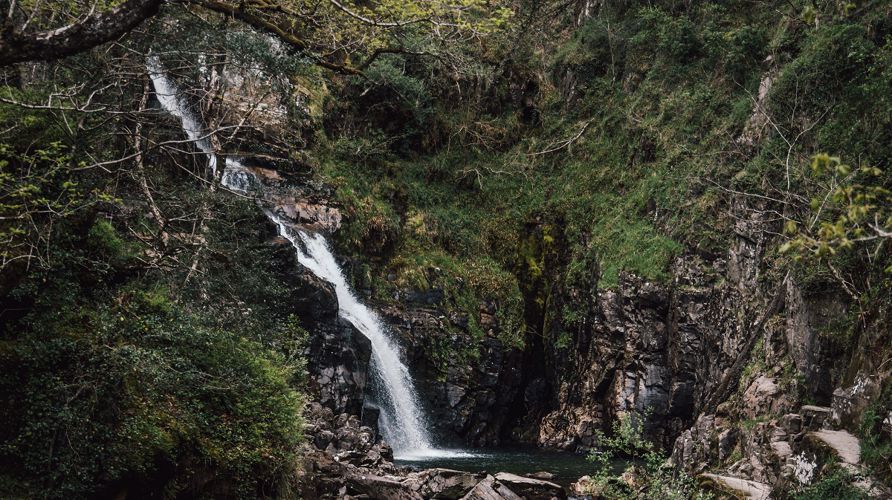
The car park is the starting point for a walking trail to the famous waterfalls known as Rhaeadr Mawddach and Pistyll Gain.
This circular trail also goes past the Gwynfynydd goldmine which closed in 1999.
There are picnic tables under large trees beside the rolling Mawddach river next to the car park.
The walking trail is waymarked from start to finish.
Look out for the information panel at the start of the trail.
Find out about walking trail grades.
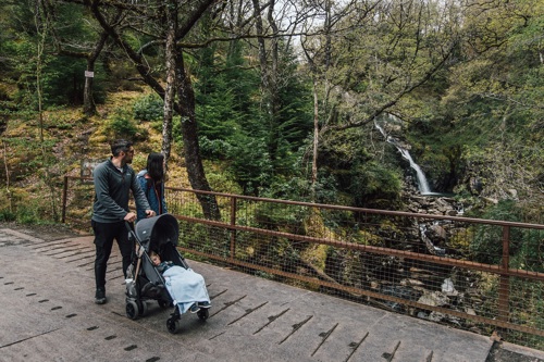
The trail is nearly all on forest road with one section of very rough private track before you get to the waterfalls and one steep but short climb 20%/1 in 5 after leaving them.
There are no steps or stiles and the trail is suitable for pushchairs and mobility scooters.
On this trail there are two benches, one picnic table and two gates with passing places 80cm wide.
Please stay on the waymarked trails as the old mine workings and buildings may be unsafe and there are unprotected drops into the river gorges.
You can also download an audio trail and listen to the history of the Tyddyn Gwladys Gunpowder Works.
Discover the stories of the people who worked at Tyddyn Gwladys Gunpowder Works and learn about the gunpowder works’ history on our audio trail.
The audio trail has been designed to be used along the Waterfalls and Goldmines Trail, a waymarked walking route from the car park.
We recommend that you download the audio trail to your smartphone before your visit as mobile network coverage can be limited in rural areas.
You can also download a PDF file of the audio trail’s script from the downloads section at the bottom of this page.
The main car parks with facilities for visitors within Coed y Brenin Forest Park are:
Coed y Brenin Forest Park is set in Eryri National Park.
Eryri is the largest National Park in Wales and is home to picturesque towns and villages and the highest mountain in Wales.
It is looked after by the Eryri National Park Authority.
For more information about visiting Eryri go to the Eryri National Park Authority website.
We want you to return home safely after your visit here.
You are responsible for your own safety as well as the safety of any children and animals with you during your visit.
For advice and tips to help you plan your visit here go to Visiting our places safely.
See the top of this webpage for details of any planned closures or other changes to visitor facilities here.
For your safety, always follow instructions from staff and signs including those for trail diversions or closures.
We may divert or close trails whilst we undertake maintenance work or other operations and we may need to close other visitor facilities temporarily.
In extreme weather, we may close facilities at short notice due to the risk of injury to visitors and staff.
You may need permission from us to organise an event or to carry out some activities on our land.
Check if you are allowed to use our land.
We recommend you follow these directions or use the Google map below which has a pin on this place’s location.
Tyddyn Gwladys car park is 7 miles north of Dolgellau.
Take the A470 from Dolgellau towards Porthmadog.
Just before leaving the village of Ganllwyd turn right onto a minor road and go over a stone bridge.
Follow the signs to Tyddyn Gwladys for 1¼ miles and the car park is on the right (you will pass the small car park for Pont Cae'n-y-coed on the way).
The Ordnance Survey (OS) grid reference for the car park is SH 734 263 (Explorer Map OL 18).
The postcode is LL40 2HS. Please note that this postcode covers a wide area and will not take you directly to the entrance.
View this place on the What3Words website.
The nearest mainline railway stations are in Barmouth (Cambrian Coast line) and Blaenau Ffestiniog (Blaenau Ffestiniog-Llandudno line).
For details of public transport go to the Traveline Cymru website.
Parking is free of charge.
Overnight parking is not permitted.
There are no staff at this location.
Contact our customer team for general enquiries during office hours, Monday to Friday.


