
The Arch, near Aberystwyth
Walks through huge beech trees with views over...
Warren Wood has been popular with tourists for over 200 years because of the waterfall known as Water-Break-its-Neck.
This is a spectacular sight after rain but can become a trickle after a long dry spell.
Warren Wood is named after the rabbit warren which once provided a source of food and this part of Radnor Forest has seen huge changes over the centuries.
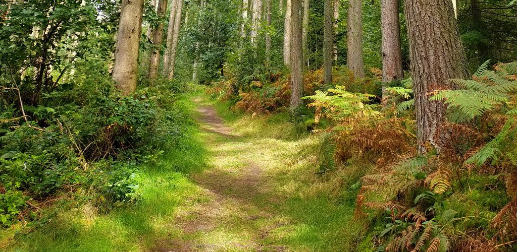
The Victorian landowners created a forest in the popular Picturesque style by planting trees on the moorland.
You can see many of these trees, which are now huge, on our walking trails.
There is a small picnic site in the parking area which you pass on your way to the main Warren Wood car park.
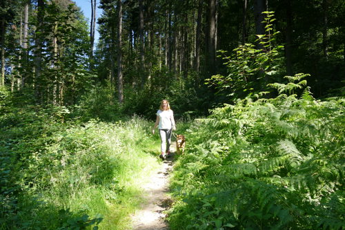
The walking trails are waymarked from start to finish.
Look out for the information panel at the start of the trails.
Find out about walking trail grades.
This short walk goes along a steep-sided gorge to the waterfall, which was a popular destination for Victorian tourists.
The waterfall is a spectacular sight after a few days of rain but it can be reduced to a trickle after a long hot spell.
The trail returns via the same route to the car park or you can join one of the longer trails through the wood.
This woodland walk goes above the famous Water-Break-its-Neck waterfall and has views down into the gorge.
This is an energetic ramble with some steep climbs.
This route has great views of some of the largest trees in Radnorshire, many of which were planted in Victorian times.
Look out for the monkey puzzle trees!
Warren Wood is in the area known as Radnor Forest.
Radnor Forest was once a royal hunting ground. In those days it wasn’t an area covered in trees but an unenclosed piece of land, legally set aside for the Norman kings to hunt deer.
Today Radnor Forest is a land of hill farming and great moorlands, steep narrow valleys and hills, rising up to the highest point in Radnorshire, Black Mixen at 2150 feet (650 metres).
There are walking trails at two other woodlands managed by Natural Resources Wales within Radnor Forest.
Go to Nash Wood and Fishpools for more information.
We want you to return home safely after your visit here.
You are responsible for your own safety as well as the safety of any children and animals with you during your visit.
For advice and tips to help you plan your visit here go to Visiting our places safely.
See the top of this webpage for details of any planned closures or other changes to visitor facilities here.
For your safety, always follow instructions from staff and signs including those for trail diversions or closures.
We may divert or close trails whilst we undertake maintenance work or other operations and we may need to close other visitor facilities temporarily.
In extreme weather, we may close facilities at short notice due to the risk of injury to visitors and staff.
You may need permission from us to organise an event or to carry out some activities on our land.
Check if you are allowed to use our land.
We recommend you follow these directions or use the Google map below which has a pin on this place’s location.
Warren Wood is 1 mile south west of New Radnor.
Follow the A44 from New Radnor to Llandrindod Wells.
About one mile after New Radnor, turn right at a brown tourist information sign.
Go past the first small parking and picnic area and follow the forest road uphill to Warren Wood car park.
The Ordnance Survey (OS) grid reference for the car park is SO 186 597 (Explorer Map 200).
The postcode is LD8 2TN. Please note that this postcode covers a wide area and will not take you directly to the entrance.
View this place on the What3Words website.
The nearest mainline railway station is in Knighton.
For details of public transport go to the Traveline Cymru website.
Parking is free of charge.
Overnight parking is not permitted.
There are no staff at this location.
Contact our customer team for general enquiries during office hours, Monday to Friday.


