
Beddgelert Forest, near Beddgelert
Huge forest in the heart of Eryri (Snowdonia)...

The orienteering course is closed.
The Llyn Elsi Walk is closed due to a damaged bridge.
Gwydir Forest Park surrounds Betws-y-coed, one of the prettiest villages in Eryri (Snowdonia) National Park.
Our waymarked walking trails set off from the village and include an easy boardwalk stroll, steep climbs up forested hillsides with far-reaching views, and walks around beautiful lakes.
Look out for our information panels in Pont y Pair car park or buy a walking guide from the Eryri National Park Information Centre in the village centre.
The public toilets in the Pont y Pair car park are managed by Conwy County Borough Council and there is a charge to use them.
The permanent orienteering course begins just outside Betws-y-coed and finishes in the centre of the village.
The walking trails are waymarked from start to finish.
Look out for the information panel at the start of the trails.
The walking trails start from the Pont y Pair car park in the centre of Betws-y-coed (apart from the Llyn Elsi Walk which starts behind St Mary’s Church).
Find out about walking trail grades.
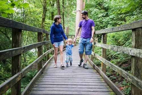
Take this short, easy walk, under tall and majestic Douglas fir trees - some are up to 100 years old.
Find the signs along the trail to discover facts about the trees.
You can also pick up a leaflet at the start of the path for the Animal Discovery Trail or you can download a copy from the bottom of this page.
Leave the bustle of Betws-y-coed on this walk with a stunning view over the town after taking a winding path through majestic Douglas firs.
Despite being high above the town, you can sometimes hear cars passing below.
Many decades ago, the background noise would have been very different: the clatter of work from the surrounding mines as mining was a big industry in this area.
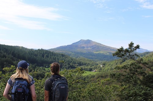
From mountains to rivers and meadows - discover this walk full of variety.
It has something to suit all tastes with shady fir forest, upland meadows, abandoned mines, a ravine-top path and a stretch along the river.
There are also breathtaking mountain views of the distinctive Moel Siabod.
It returns along the River Llugwy where there is a diversion if the path has become flooded after a lot of rain.
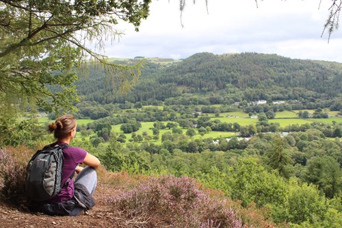
Enjoy lake views, a vista over Llanrwst, and some forest artworks.
Follow the waymarkers on a steadily ascending trail to Llyn Parc lake.
Continue on along a forest road that takes you high above the Conwy Valley with beautiful views towards the town of Llanrwst.
The return journey meanders along the bank of Llyn Parc, a natural lake that was dammed to power mining machinery in the Aberllyn gorge.
From here follow the water down through the gorge, past several mine entrances and back into the bustle of Betws-y-coed.
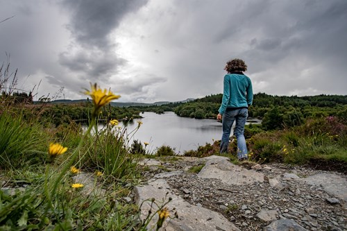
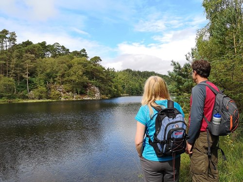
Leave the bustle of Betws-y-coed to discover a tranquil and scenic lake.
The scenery, wildlife and peaceful atmosphere as you walk around Llyn Elsi are really worth the hike up from the village.
Follow the path around the lake as it cuts in and out from the water’s edge until you join the main path to re-trace your steps back to Betws-y-coed.
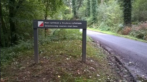
Test your map-reading skills by navigating between wooden marker posts on the permanent orienteering course in Gwydir Forest Park.
The Orange Course is graded to British Orienteering Federation standards and was designed by Eryri Orienteers.
The course begins just outside Betws-y-coed and finishes in the centre of the village.
To reach the starting point, follow the minor road (Ffordd Craiglan) alongside Cotswolds Outdoor (Arfon House) out of Betws-y-coed. After around 120m there is a lay-by on the left (OS grid reference SH 795 559) – look out for the orienteering sign at the side of the road.
The Orange Course has medium navigational difficulty and 10 controls.
Gwydir Forest Park lies in the heart of the Eryri (Snowdonia) National Park and encircles the village of Betws-y-coed.
Lead and zinc mining once dominated the area and the legacy of old engine-houses, waste tips and reservoirs are characteristic features of the forest landscape today.
Several of the most important mines have been partially restored and made safe for visitors.
In addition to the walks from Betws-y-coed, waymarked trails start from several other Natural Resources Wales car parks in Gwydir Forest Park:
Gwydir Forest Park is set in Eryri (Snowdonia) National Park.
Eryri is the largest National Park in Wales and is home to picturesque towns and villages and the highest mountain in Wales.
It is looked after by the Eryri National Park Authority.
For more information about visiting Eryri go to the Eryri National Park Authority website.
Gwydir Forest Park forms part of the National Forest for Wales.
The National Forest will:
It will form a connected ecological network running throughout Wales, bringing social, economic and environmental benefits.
Parts of the network will eventually form a trail running the length and breadth of Wales, so anyone can access it wherever they live.
For more information go to the National Forest for Wales website.
We want you to return home safely after your visit here.
You are responsible for your own safety as well as the safety of any children and animals with you during your visit.
For advice and tips to help you plan your visit here go to Visiting our places safely.
See the top of this webpage for details of any planned closures or other changes to the trails here.
For your safety, always follow instructions from staff and signs including those for trail diversions or closures.
We may divert or close trails whilst we undertake maintenance work or other operations and we may need to close other visitor facilities temporarily.
In extreme weather, we may close facilities at short notice due to the risk of injury to visitors and staff.
Betws-y-coed is located at the junction of the A5 and the A470, 5 miles south of Llanrwst.
It is in the county of Conwy.
Betws-y-coed is on Ordnance Survey (OS) Explorer map OL 17.
The OS grid reference is SH 791 567 (Pont y Pair car park).
The walking trails start from the Pont y Pair car park in Betws-y-coed (except the Llyn Elsi Trail).
Follow the A5 through Betws-y-coed village centre and turn onto the B5106 signposted to Trefriw.
Go over a stone bridge and turn immediately left onto a minor road and after 50 metres the Pont y Pair car park is on the right.
The Llyn Elsi Trail starts behind St Mary’s Church in the centre of Betws-y-coed, five minutes walk from Pont y Pair car park.
The nearest mainline railway station is in Betws-y-coed.
For details of public transport go to the Traveline Cymru website.
Pont y Pair car park is operated by Conwy County Borough Council.
There is a parking charge.
There are no staff at this location.
Contact our customer team for general enquiries during office hours, Monday to Friday.


